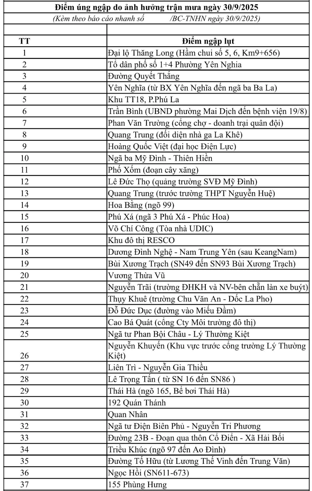
Hanoi issued a level 1 flood alert on the Tich and Bui rivers, with many inner-city locations at high risk of flooding. Authorities called on people to monitor information and take proactive measures to avoid flooding.
Faced with the current complicated developments of storms and rains, the Hanoi City Steering Committee for Natural Disaster Prevention and Search and Rescue has just issued a level I flood alert on the Tich and Bui rivers, in order to promptly respond to the risk of flooding in many localities.
According to data from the Northern Hydrometeorological Station, from 1am on September 29 to 1am on September 30, the total rainfall in Hanoi was generally from 70 to 130mm. Some areas recorded heavy rainfall exceeding the average such as Suoi Hai 226.4mm, Bat Bat 199.8mm, Ba Vi 193mm, Huong Son 172.6mm, Son Tay 160mm, Quang Oai 157mm. Prolonged heavy rain has caused the water levels of the Tich, Bui, Day rivers... to rise rapidly, posing a risk of flooding in the downstream areas.
Based on actual data, on the morning of September 30, the Hanoi City Civil Defense Command issued a level I flood alert on the Tich River in the following communes and wards: Ha Bang, Kieu Phu, Phu Cat, Phu Nghia, Son Tay, Phuc Tho, Doai Phuong, and Thach That. At the same time, a level I flood alert on the Bui River was also deployed in the communes of Xuan Mai, Phu Nghia, Tran Phu, Quang Bi, Hoa Phu, and Phuc Son. The Command requested relevant units and localities to strictly implement flood prevention measures when ordered, in order to minimize risks to people and infrastructure.
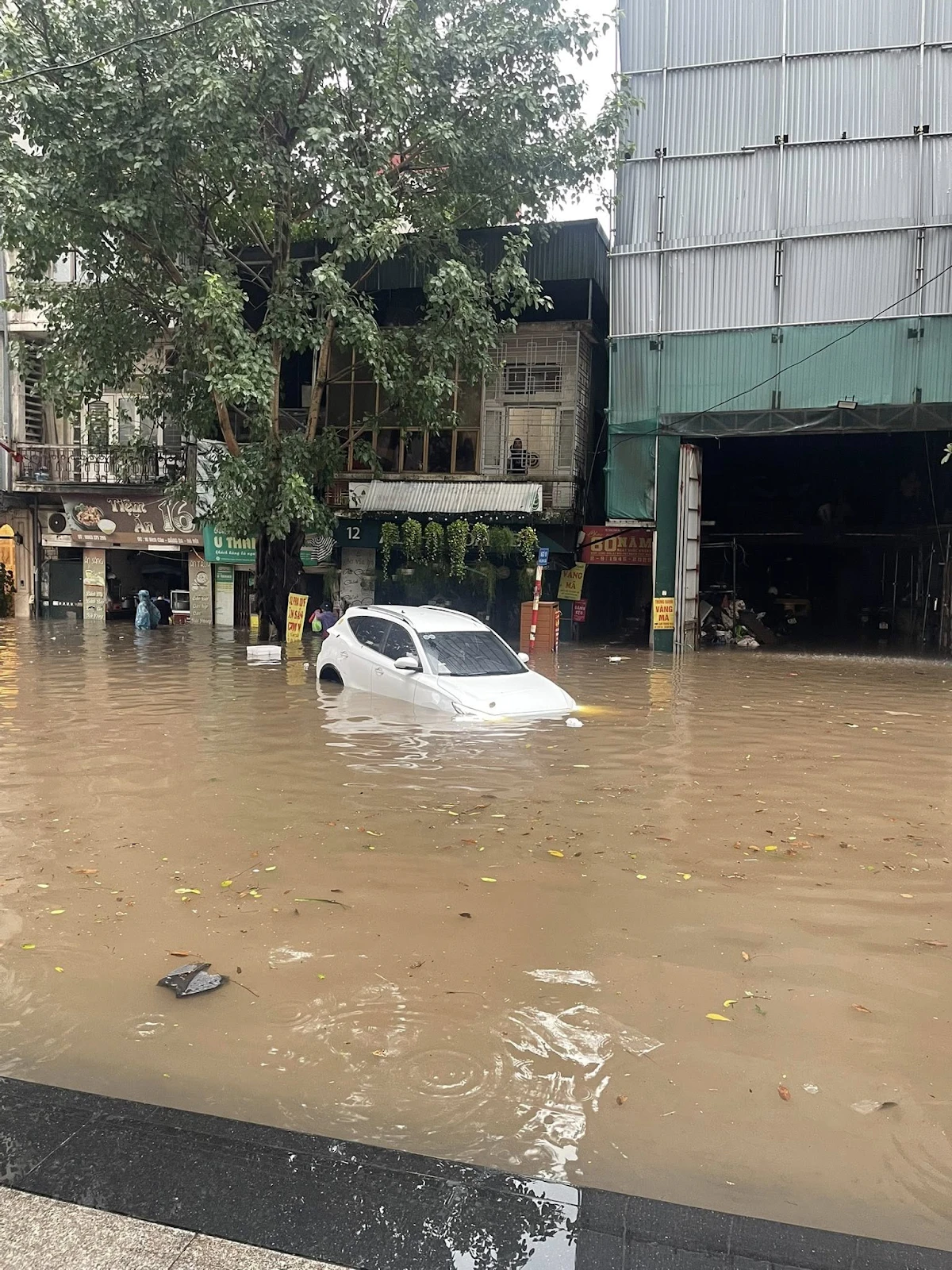
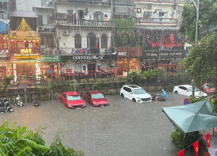
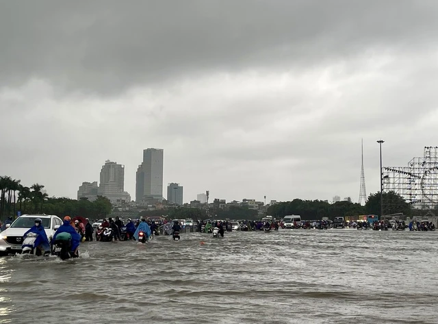
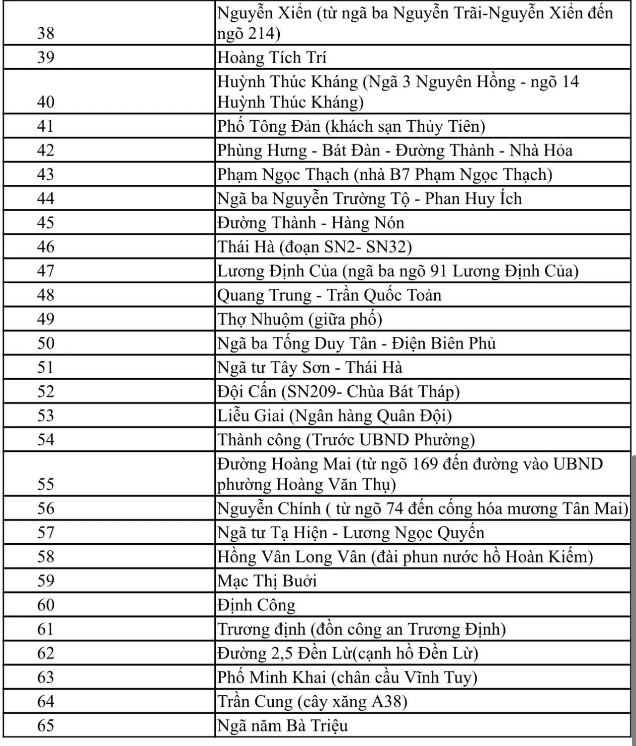
Not only riverside areas, Hanoi's inner city is also facing flooding. According to the report of Hanoi Drainage Company Limited at 7am on September 30, rain due to the influence of storm Bualoi started from the night of September 29, with rainfall measured at some locations such as Tay Mo 169mm, Phu Luong 118mm, Xuan Mai 198mm. Water levels in inner city rivers also recorded high levels: To Lich River (Hoang Quoc Viet) 3.85m; Thanh Liet Dam 2.90m; Lu River 3.01m; Kim Nguu River 3.01m.
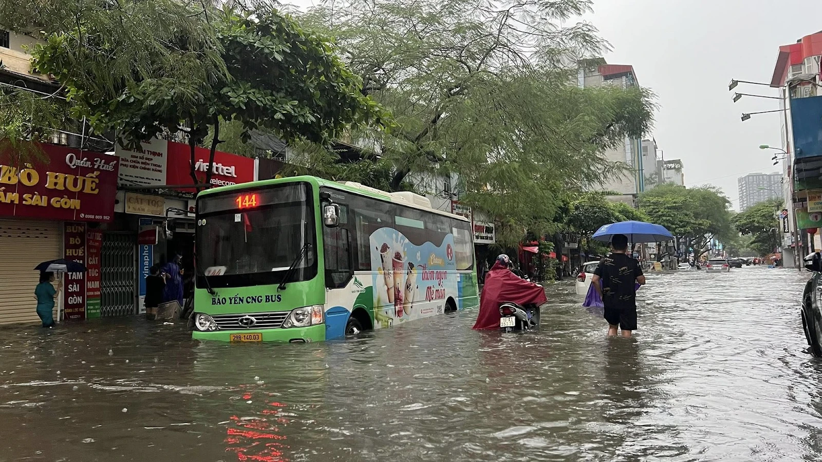
There have been some flooding points, causing traffic difficulties, typically underpass No. 5 and 6 on Thang Long Avenue (Km9). To respond, Hanoi Drainage Company has deployed forces at key points and operated large pumping stations such as Yen So, Cau Buu, Dong Bong 1-2, Co Nhue, Da Sy. Currently, Yen So pumping station is operating 5/20 units, with sluice gates operating according to the correct procedures to ensure the safety of the drainage system.
With heavy rains likely to continue, the city government recommends that people proactively monitor weather forecasts, limit travel through flooded areas, and follow instructions from authorities. In addition, households living near rivers and low-lying areas should prepare preventive measures such as elevating assets, stocking food and drinking water, and ensuring rescue vehicles in case of emergency.
Close coordination between local authorities, rescue forces and people is considered an important factor to minimize damage, ensure safety of life and property during this year's rainy and stormy season. At the same time, continuous updates on the flood situation also help authorities promptly adjust response plans, ensuring safety for people and key infrastructure works of the city.
Pickup truck driving like crazy in Kham Thien: driver explains why netizens 'turned around'  Mỹ Hoa09:24:02 24/07/2025A horrific collision just happened on Kham Thien Street, Hanoi. A blue Ford Raptor pickup truck suddenly lost control, jumped onto the sidewalk, and plowed into about 6-7 parked motorbikes, causing panic among passersby.


 Police reveal about the woman who spread strange powder: Has signs of mental illness
 1xBet and Paris Saint-Germain extend partnership for 3 more seasons
 Criminally prosecute Huong Ly for slandering Bui Quynh Hoa, police declared!
 Laser lithotripsy machine broken for 2 years, doctor's irresponsible explanation causes controversy
 "CEO" ordered to "deal with" coffee shop staff in Hanoi, initial reason shocking?
 Traffic police urgently verify blue-plate car driving 'in the wrong direction' in Hue
0 | 0 Discuss | Report