Storm Trami intensifies, unusual path, Central region at risk of historic flooding like 2020
3 | 1 Discuss | Share
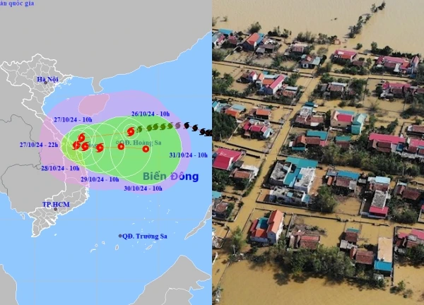
Storm No. 7 (Yinxing) suddenly increased to level 15, gusting over level 17 this afternoon. This is likely the strongest level of this storm in the East Sea, tomorrow, the storm will weaken rapidly.
The National Center for Hydro-Meteorological Forecasting said that at 4:00 p.m. on November 9, storm No. 7 (storm Yinxing) was at about 19 degrees north latitude; 113.9 degrees east longitude, in the northern East Sea, about 370 km northeast of the Hoang Sa archipelago. The strongest wind near the storm's center was level 14 - level 15 (150 - 183 km/h), gusting above level 17.
In the next 24 hours, storm No. 7 will move west-northwest at 10-15 km per hour and then begin to weaken. At 4:00 p.m. on November 10, storm No. 7 will be in the northwest sea of the northern East Sea, about 280 km north of the Hoang Sa archipelago. The storm is at level 12-13, gusting to level 16, moving at 5-10 km per hour and weakening further as it approaches land.
At around 4pm on November 11, the storm was located about 160km west-northwest of the Hoang Sa archipelago. The storm was at level 9, gusting to level 12, and continued to weaken into a tropical depression, then a low pressure area when it made landfall in the area from Quang Nam to Binh Dinh.
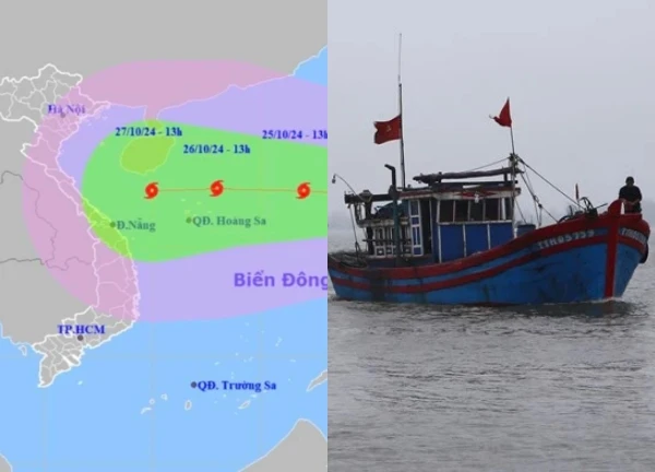
Due to the influence of storm No. 7, the northern East Sea has strong winds of level 8 - level 11, near the storm's center, level 12 - level 15, gusts above level 17, waves 4 - 6 m high, near the center, 7 - 10 m, rough seas. Experts warn that with such strong winds and large waves, all ships operating in the dangerous area are at risk of being sunk.
Mr. Mai Van Khiem, Director of the National Center for Hydro-Meteorological Forecasting, said that with the current environmental impact, storm No. 7 will reach its strongest intensity in the next 48 hours. Therefore, this afternoon and tonight, the storm is likely to continue to strengthen.
However, the deeper it goes into the East Sea, storm No. 7 will encounter unfavorable factors such as cold air, surface, and humidity, so it will weaken when it reaches the central sea.
According to Mr. Khiem, in recent days, international forecasting models have not been highly consistent about storm No. 7. Specifically, Japanese agencies forecast that the storm will be at its strongest on the afternoon of November 8 and will gradually weaken thereafter. The US and China also have the same opinion, but the storm is likely to strengthen to level 14 - level 15.
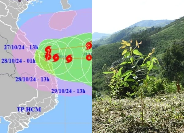
Mr. Khiem added that the direction of movement of storm No. 7 is currently controlled by the subtropical high pressure environment, so it is difficult for it to move north. Therefore, when it enters the north of Hoang Sa archipelago, the storm will change direction to West Southwest and head towards the Central Central Sea.
Mr. Khiem continued to inform that, through satellite analysis, in addition to storm No. 7, the tropical convergence zone across the equatorial region has many turbulence areas forming and potentially developing into storms and tropical depressions. Therefore, in addition to this storm No. 7, people need to pay attention to respond to the next storms that may form from the Philippines.
Meanwhile, Deputy Minister of Agriculture and Rural Development Nguyen Hoang Hiep emphasized that storm No. 7 is a strong storm with forecast strength of level 15 and gusts above level 15. The lucky thing is that the storm is at its strongest in the East Sea and is likely to weaken, and when it gets closer to shore, it may decrease in level even more. However, "we should not be complacent because of that."
Mr. Hiep said that the storm will change in intensity and direction. However, forecasts show that storm No. 7 will make landfall in the Central region, while this area has recently been affected by three natural disasters. People are currently feeling tired, which will make it difficult to direct the work.
The Deputy Minister noted that currently, reservoirs in the Central region are full, many reservoirs are overflowing, so there is a very high risk of insecurity. In addition, in the past 10 days, mountainous areas from Quang Binh to Quang Ngai provinces have "absorbed" enough water, just a small impact will lead to the risk of landslides in the mountains. Therefore, localities need to focus on ensuring safety at sea, calling on boats to take shelter from storms and implementing measures to ensure safety for aquaculture areas.
Typhoon Yinxing's unpredictable path, constant change of direction, the central region is worrisome  Phi Yến22:08:53 08/11/2024After Trami, Yingxing continues to be a storm with complicated developments. The storm will affect the Central and Central provinces, on November 11-13, this area has rain, moderate rain, in some places heavy to very heavy rain.

3 | 1 Discuss | Share
1 | 1 Discuss | Share
5 | 1 Discuss | Share
3 | 0 Discuss | Share
5 | 0 Discuss | Share

4 | 0 Discuss | Share

2 | 0 Discuss | Share


4 | 1 Discuss | Report