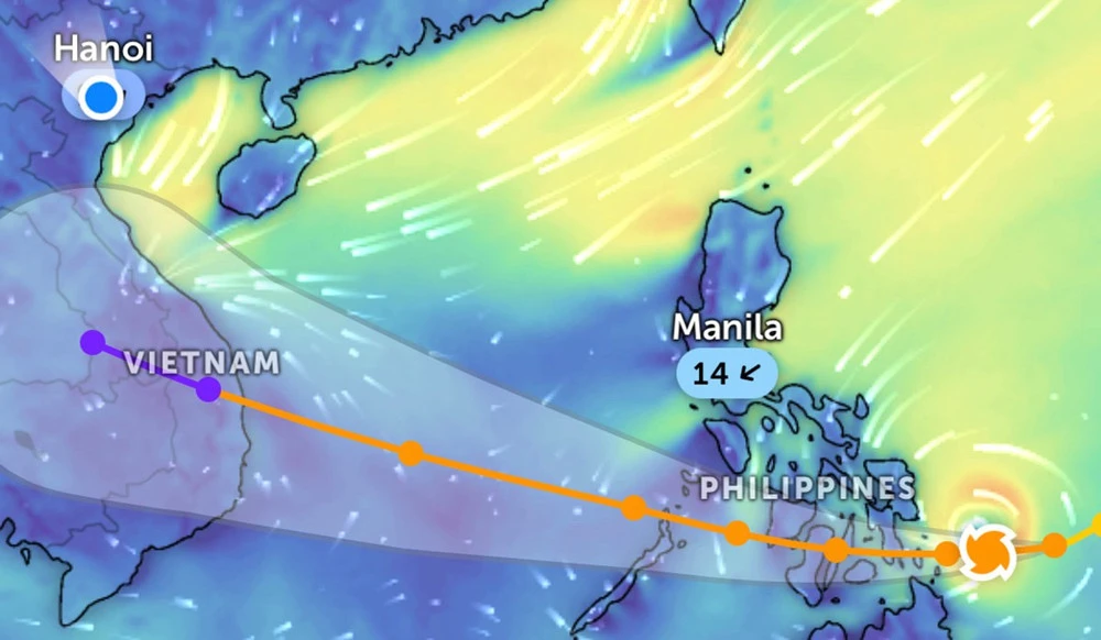
Typhoon Kalmaegi with a level 16 gust has entered the South China Sea, becoming Typhoon No. 13 in 2025. With a wide circulation and extremely strong intensity, the storm can reach level 14 when passing through the Spratly Islands and the waters of Da Nang - Khanh Hoa.
Typhoon No. 13 Kalmaegi is considered one of the strongest typhoons in 2025 in the South China Sea. When passing through the area between the East Sea, especially the Truong Sa sea and the coast of Da Nang - Khanh Hoa, the storm reached the intensity of level 13-14, gusting to level 16-17, causing violent sea turbulence and directly threatening the central provinces.
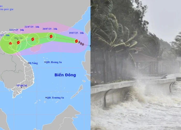
According to the National Center for Hydrometeorological Forecasting, early on the morning of November 5, Typhoon Kalmaegi entered the eastern sea in the middle of the South China Sea, becoming Typhoon No. 13 in 2025.
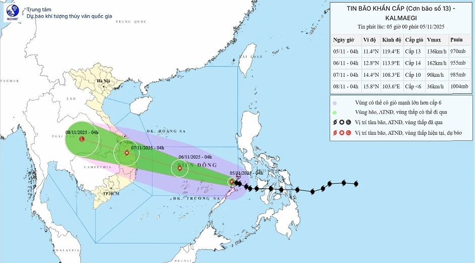
At 6 a.m., the center of the storm was about 510km east of Gemini West Island. The strongest wind in the area near the center reached level 13 (134-149km/h), gusting to level 16. In the next 3 hours, the storm will move west-northwest, with a speed of 20-25km/h.
It is forecasted that by 4 am on November 6, the center of the storm will be about 550km east of the coast of Gia Lai, continuing to strengthen to level 14, gust level 17. The middle area of the South China Sea, including the northern waters of the Spratlys, is warned of natural disaster risk level 4 – a very dangerous level.
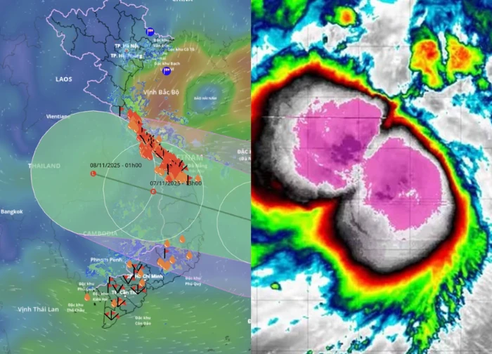
At about 4 am on November 7, Typhoon Kalmaegi is expected to make landfall from Quang Ngai to Dak Lak, moving quickly west-northwest 25km/h, then weakening to level 9-10, gusting to level 12. According to the meteorological agency, Kalmaegi is a strong storm with a wide circulation, with a path and impact similar to Typhoons Damrey (2017) and Molave (2020). When passing through Truong Sa and the waters of Da Nang – Khanh Hoa, the storm can reach above level 14.
In the middle of the East Sea, strong winds of level 8-11, areas near the center of level 12-14, gusts of level 17, waves of 5-7m high, areas near the center of the storm 8-10m, violently rough seas. From the morning of November 6, the sea area of Da Nang – Khanh Hoa (including Ly Son) increased to level 8-11, gusting to level 17. The coast from Hue to Dak Lak waves are 4-6m high, near the center 6-8m, the water rises 0.3-0.6m. Low-lying areas are at risk of flooding, landslides, and waves overflowing the banks.
From the evening of November 6, the wind gradually strengthened in the South of Quang Tri – Da Nang, the east of Quang Ngai – Dak Lak reached level 8-9, gusts of level 14-15; in the west of this area, the wind is level 6-7, gusting to level 10. On November 6-7, the Da Nang – Dak Lak area had very heavy rain of 200-400mm, the highest place was over 600mm/wave. The provinces of South Quang Tri, Hue, Khanh Hoa, Lam Dong rained 150-300mm, locally over 450mm/wave.
From 8/11, rain tends to decrease, but the area from North Quang Tri to Thanh Hoa still has heavy rain of 50-150mm, in some places over 200mm/wave. The forecast agency warned of the possibility of extremely heavy rain, rainfall exceeding 200mm in just 3 hours, accompanied by thunderstorms, tornadoes, strong gusts of wind before and during the storm's landfall.
From the evening or night of November 6, the storm directly affected the mainland from Da Nang to Khanh Hoa, strong winds of level 10-12, gusts of level 14-15. The Central Highlands area may have winds of level 8-9, gusts of level 11. From Ha Tinh to Khanh Hoa, heavy to very heavy rain is forecast. This is a strong storm with a wide range of influence, expected to cause prolonged heavy rain.
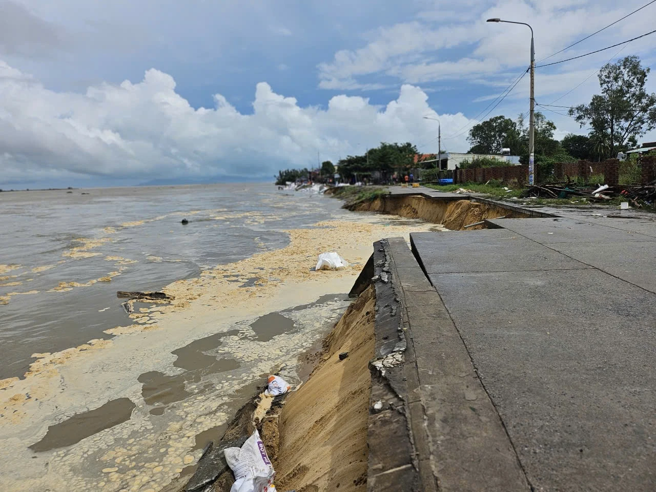
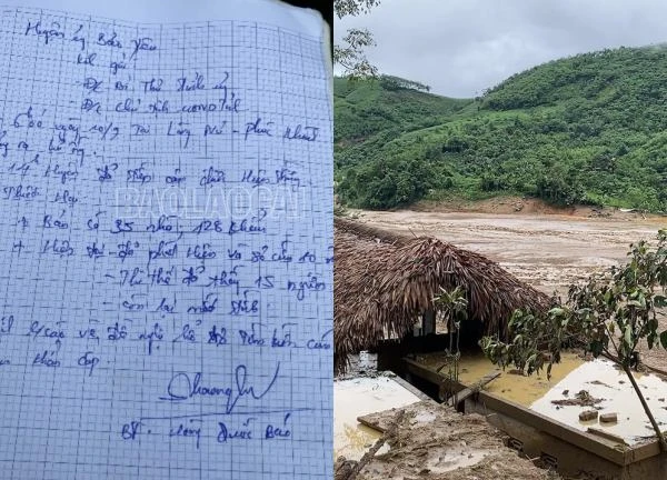
Currently, the Central region has just experienced a historic flood that caused heavy damage (as of November 3: 46 people died and went missing, 76 people were injured, 104 houses collapsed, hundreds of traffic, education and health projects were damaged).
Faced with that situation, the Prime Minister has asked localities to proactively respond, ensure the safety of people, ships and infrastructure, minimize damage to people and property when Typhoon Kalmaegi makes landfall.
Le Anh Nuoi was accused of exploiting the image of the army to sell goods, Joint Stock Company 26 spoke up.  An Nhiên11:36:31 29/10/2025TikToker Le Anh Nuoi has caused controversy after being accused of using the military's image to sell private goods. He has appeared in livestreams with the logo of 26 Joint Stock Company, causing viewers to misunderstand his true role.


 The makeup remover suspected to be demanding: HannahOlala responds, fans divide the controversy
 Horrific floods in Hue: Heavy flooding, people face life-threatening danger
 Ho Chi Minh City takes strong action against artists who violate standards, Jack, HIEUTHUHAI, Phao are named
 Arrested the subject who dared to accept 8 billion to 'fix the case' for Ngan 98 and her husband, shocking identity revealed!
1 | 0 Discuss | Report