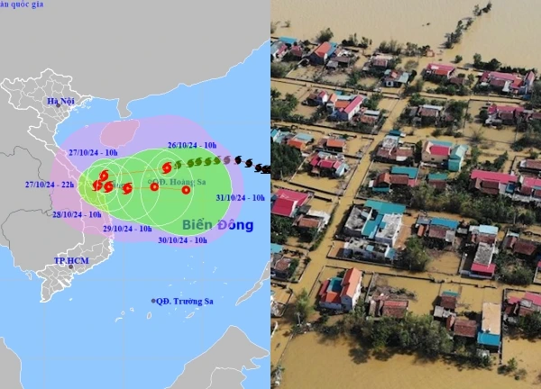
Storm No. 6 will make landfall on the evening of August 30, with the strongest winds from 3-7pm. The storm's eye will pass through the Thanh Hoa - Quang Tri area, causing widespread heavy rain. Many people are concerned that the scenario of Storm No. 5 will repeat itself, with heavy rains pouring down across the North and Central regions.

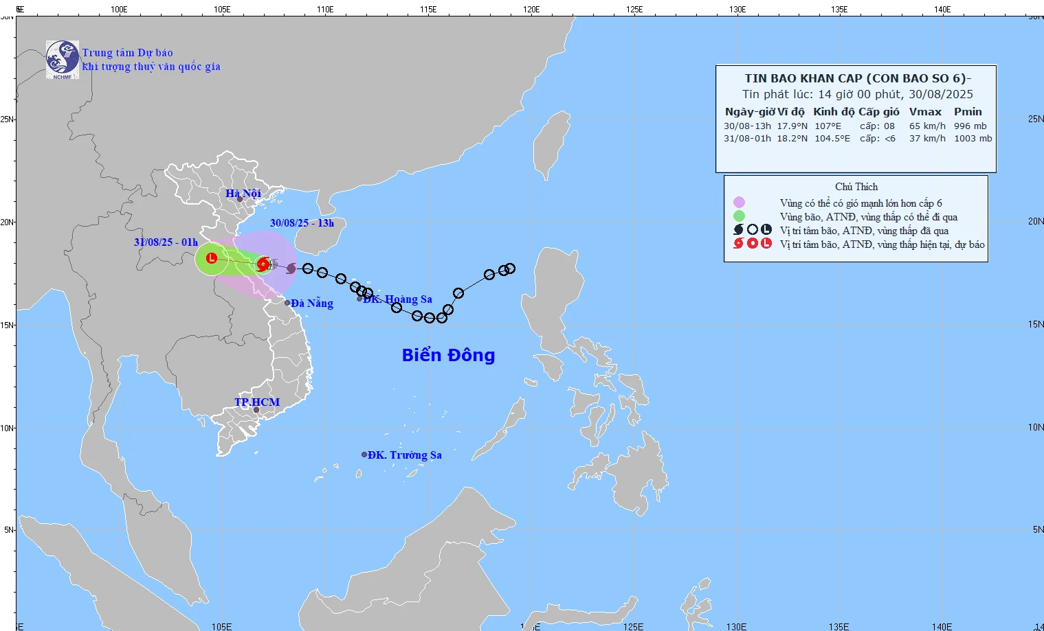
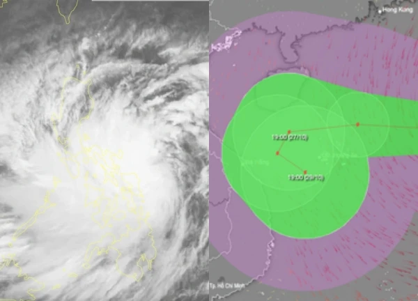
Recently, Mr. Nguyen Van Huong, Head of the Weather Forecast Department, National Center for Hydro-Meteorological Forecasting, provided extremely important information about the developments of storm No. 6 (international name Nongfa) which is heading straight towards the mainland. This morning, in the northwest sea area of Hoang Sa special zone, the tropical depression has strengthened into a storm, becoming the 6th storm operating in the East Sea this year. According to experts, although this is not a large storm, it has the potential to cause unpredictable destruction, especially when it makes landfall in areas that have just been heavily affected by storm No. 5.
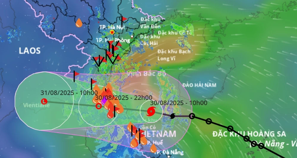
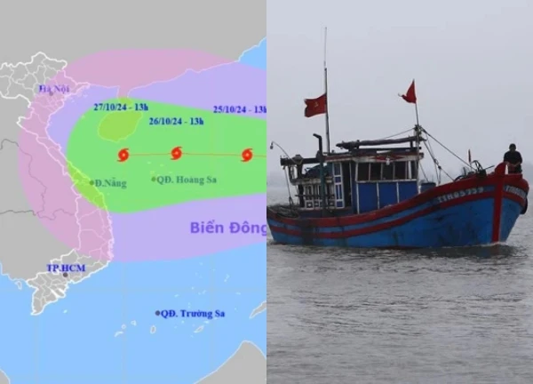
At 10am this morning, the eye of the storm was about 120km east of North Quang Tri (formerly Quang Binh), with strong winds of level 8, gusts of level 10-11 and moving at a fast speed of 20-25km/h. According to forecasts, this afternoon and evening, the eye of the storm will make landfall in the provinces from South Ha Tinh to North Quang Tri, with strong winds of level 6-7, and near the eye of the storm at level 8.
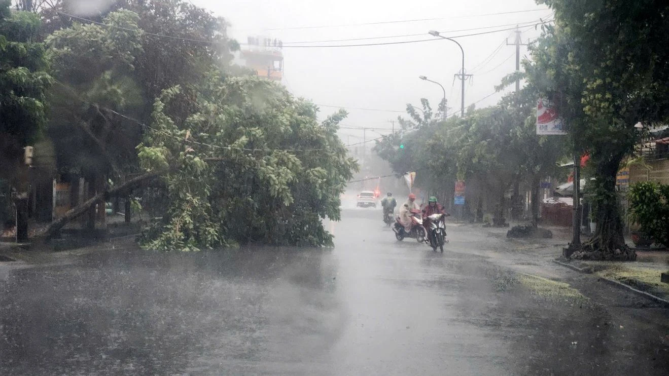
Mr. Huong especially noted that the wind gusts in the storm can be 3 to 4 levels different from the storm wind. This means that although the storm wind may only be strong at level 7-8, the wind gusts can reach level 9-10, even level 11, level 12. This wind level is capable of breaking tree branches, blowing off roofs, causing serious damage to houses. The waves will be very strong, very dangerous for boats, especially fishermen in coastal areas on rafts need to be extremely careful.
Floods and rains: A dire scenario awaits
Mr. Huong emphasized that storm No. 6 will cause two main impacts: wind and rain. After warning about the terrible wind gusts, Mr. Huong continued to make worrying comments about the heavy rain situation. The area from Thanh Hoa to Quang Tri will be the center of heavy rain, with the total rainfall for the whole period estimated to be from 200-400mm, some places over 600mm. From now until the end of August 31, the area from Thanh Hoa to Northern Quang Tri will continue to have heavy rain, with a total rainfall of 150-250mm, some places over 350mm. After that, the rain will expand to the midlands and the Northern Delta from this evening until the end of August 31, with a total rainfall of about 50-120mm, some places over 200mm.

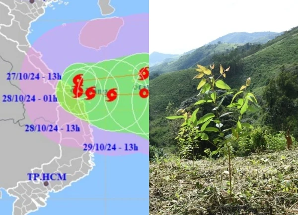
What makes meteorological experts particularly worried is that storm No. 6 moves relatively quickly, although it does not cause prolonged heavy rain, it directly hits areas that have just been heavily affected by storm No. 5. At the Operation Center of the Department of Hydrometeorology, representatives of the units agreed that although the storm is not large, it directly impacts areas that have just been damaged, creating a double danger.

Localities need to be extremely cautious about winds in coastal areas, the risk of strong gusts and large waves that can impact sea dykes and cause landslides. In particular, rain before, during and after the storm is the greatest danger for localities that have just been affected by storm No. 5, increasing the risk of landslides, flash floods and inundation.
The "fateful" moment and a vital warning
According to Mr. Huong, by noon today, the storm's circulation has affected coastal areas of the provinces from Thanh Hoa to Hue. With its West-Northwest direction and fast speed, experts warn that the time the storm arrives, around 3-7pm this afternoon, is when the winds on land as well as in coastal areas are strongest.
This is a "fateful" time when the lands that are still struggling to overcome the consequences of the previous storm will have to face a new challenge. This overlap increases the risk of disaster many times over, making it impossible for the government and people to be negligent. Obviously, storm No. 6 is not just a normal storm, but also a test of the resilience and response capacity of the Central provinces. The warning from experts is not only weather information but also a "vital" reminder for millions of people living in these areas.

Quang Hai's wife is suspected of taking advantage of the storm to sell goods, but when discovered, she immediately took shocking action!  Hany Đan17:12:33 27/08/2025Information about storm No. 5 affected many people, taking advantage of the situation, Quang Hai's wife posted a picture of a flooded warehouse, causing public confusion. However, people quickly realized that the picture was fake, Quang Hai's wife immediately took shocking action.


 Cao Tien Doan "Football boss" of Thanh Hoa, information about house search causes a stir
 Miss Audition Ngoc Anh was arrested and detained urgently, 4 key accomplices were revealed
 Unexpected revelation about the amount of money Uncle Ba Minh received, Dong Thap Police issued a "hot" warning
 The case of a wife 'punishing' her husband in Phu Tho: the perpetrator cried with regret and revealed the cause of the conflict
 Husband 'deals with' wife then burns down house in Ca Mau: close-up of fire spreading to 56 kiosks, shocking
 The tricks of "walking to earn money" and "raising spiritual animals" swindle billions of dong, the truth is revealed!
 Girl "ordered 30 cups of tea and asked each person to write down their name" apologized, shipper was suspended
 Male tourist missing in Cuc Phuong forest: confirmed dead, last location revealed
 Transferring 50 million to bring relatives home: Younger brother is upset, rescue team speaks up
 Technology car driver case 'tried' in Central America West, suspect arrested, shocking motive revealed
4 | 0 Discuss | Report