At the National Hurricane Center, forecasters got one key factor right from the start. In the first forecast, released Saturday, Hurricane Milton’s path was nearly identical to where it would eventually make landfall in Siesta Key, Florida.
This is impressive because typically, four days from land, the average error in a hurricane's track forecast is about 150 miles.
However, in the days that followed, the storm's path continued to swing north and south, leaving residents worried about the various potential impacts. Tampa residents were particularly concerned about a scenario where the storm would hit northern Tampa Bay during high tide, causing historic waves.
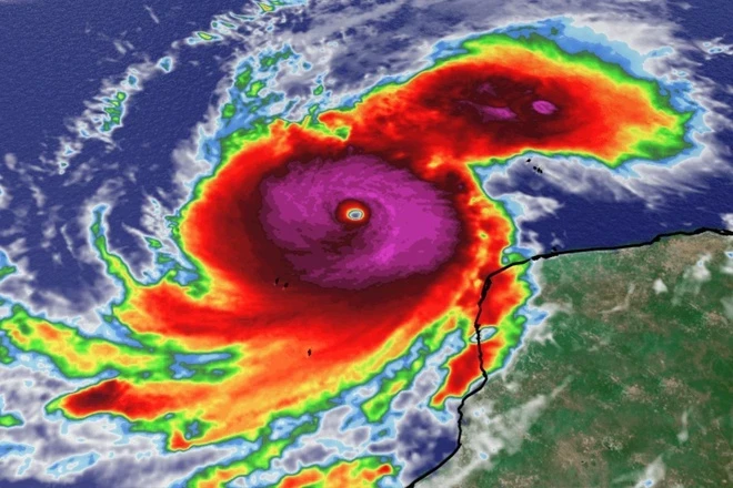
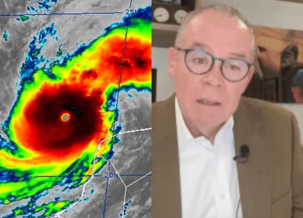
Initially, forecasters did not estimate Milton’s true strength, thinking it would only be a Category 2 storm when it made landfall. However, within hours, they realized that Milton had the potential to become a major Category 3 or higher hurricane. From October 6 to the evening of October 7, Milton rapidly grew from a tropical storm into one of the strongest hurricanes ever recorded in the Gulf of Mexico.
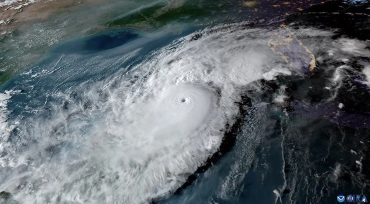
By Monday evening, the storm’s winds had reached 180 mph, making it the strongest hurricane ever recorded in the Atlantic, matching Hurricane Allen in 1980, which had a peak wind speed of 190 mph. At the same time, hurricane hunter aircraft recorded a pressure of 897 millibars at the center of the storm, with only five other Atlantic hurricanes ever approaching 900 millibars.
Prior to landfall, Milton underwent an eyewall replacement. A new wall of clouds began to form around the smaller eyewall, reducing the moisture supply to the storm, creating a larger but weaker eyewall. This reduced the storm's intensity, but left it with a larger area of impact at landfall.
By October 8, Milton had returned to Category 5 strength at a larger size, creating a terrifying sight with an eye large and distinct enough to be seen from below. Although the storm continued to weaken thereafter, emergency management agencies were still preparing for the worst.
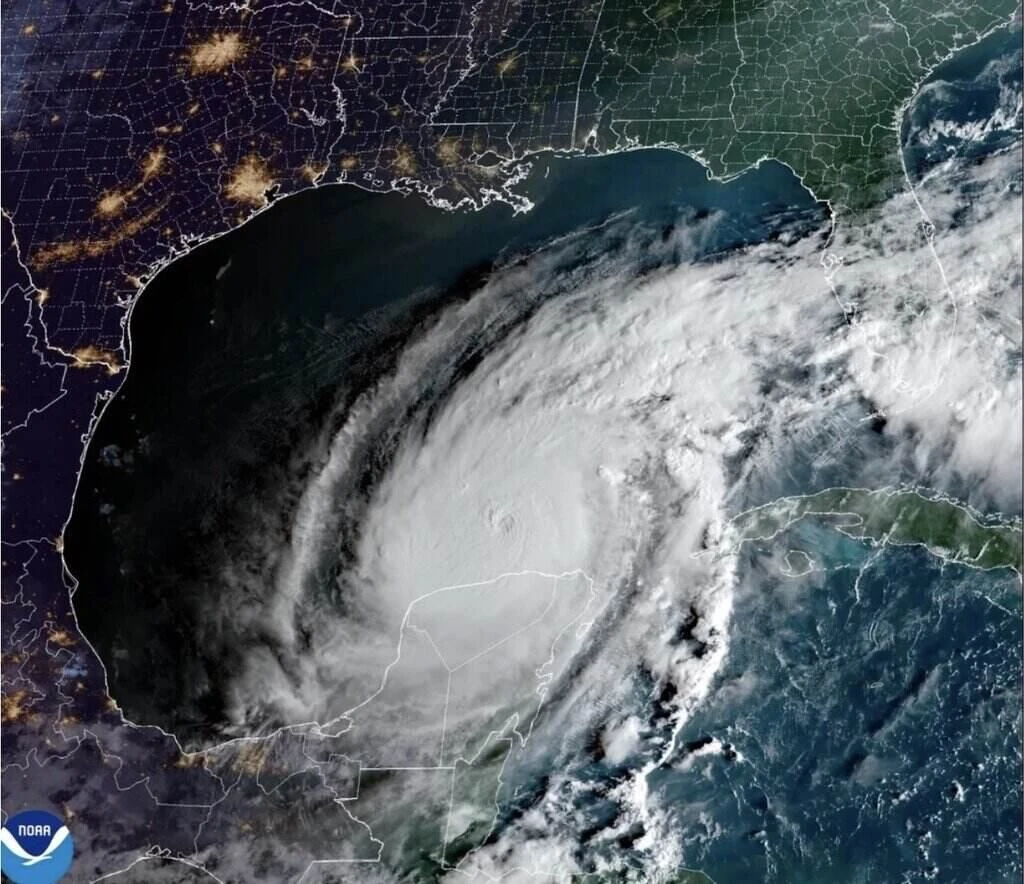
As Milton moves closer to land, meteorologists predict that while winds will ease, other threats from the storm will remain severe. On Wednesday, as the storm’s outer cloud bands swept across the Florida peninsula, powerful and deadly tornadoes appeared out of nowhere.
Typically, tornadoes that appear before a hurricane landfall are weak and short-lived. However, the tornadoes that accompanied Milton were unusual and much stronger. The National Weather Service issued more than 100 tornado warnings, and at least 38 tornadoes were reported.
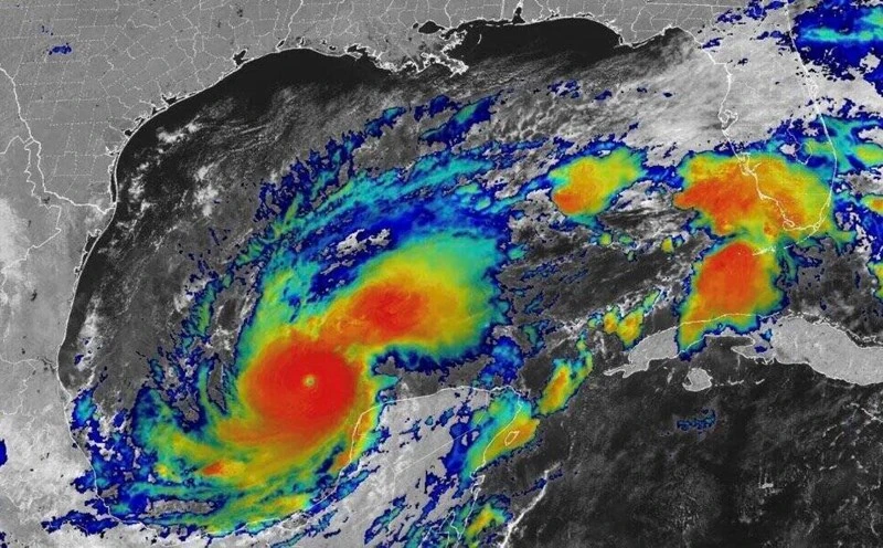
As it moved closer to the coast, Milton became noticeably unbalanced, with much of its rainfall concentrated to the north. Interaction with cooler, drier air pushed the storm northeast toward Sarasota. This weakened Milton to a Category 3 storm at landfall, and expanded its wind range further.

Although satellite and radar imagery showed the storm was out of balance, winds remained strong on both sides of the eye. In the south, large waves were hitting the shore, while in Tampa Bay, strong winds briefly pushed water onto the shore, creating a back tide. Had Milton not been out of balance, the storm could have lasted longer and caused more damage.
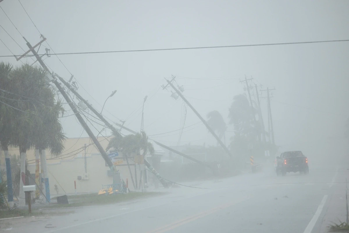
As Milton teetered on the edge of landfall, heavy rainfall was concentrated north of the storm's center, creating a rain band along Interstate 4 that affected the St. Petersburg, Tampa, and Orlando areas. Some areas recorded up to 18 inches of rain. The St. Petersburg area even recorded a "once in a thousand years" rainfall.

Duong Trieu Vu panicked while running from a storm in the US, witnessing a terrifying scene in his life.  T.P09:03:44 11/10/2024Duong Trieu Vu said that after 30 years of traveling between Vietnam and the US, and often staying in Orlando, he is very familiar with storms. Therefore, despite the media talking a lot about super storm Milton, after finishing his show last weekend, he still returned to Orlando.


 Secretly took my uncle to see A80, thinking that the 'love language' of who suspected 'evidence' for his wife to go to court
 VTV cameras cause a fever of parades, no matter how heroic the orange is, the identity is terrible!
 Prime Minister's wife Pham Minh Chinh appeared "radiant", at the ceremony of 2/9 causing a storm in social media
 Le Hoang Hiep "revealed" a 20-second clip, a small action caused a storm, people went crazy
 Southern female guerrilla - An Thu participates in A80 causing a fever with top achievements
 The wedding photo set "has 1-0-2" of PK-KQ soldiers in the middle of the A80 review, causing a storm on social media
 Two "beautiful ladies" on armored vehicles cause a stir at the parade - "more charismatic than in the movies"
 99-year-old veteran attends A80 rehearsal attracting millions of views
4 | 1 Discuss | Report